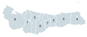
Atlántida Department
Atlántida | |
|---|---|
Department | |
 | |
 | |
| Country | |
| Municipalities | 12 |
| Founded | 1887 |
| Seat | La Ceiba |
| Government | |
| • Type | Departmental |
| Area | |
• Total | 4,372 km2 (1,688 sq mi) |
| Population (2015)[1] | |
• Total | 449,822 |
| • Density | 100/km2 (270/sq mi) |
| Time zone | -6 |
| Postal code | 31101 |
Atlántida (Spanish pronunciation: [aˈtlantiða]) is a department located on the north Caribbean shore of Honduras, Central America. The capital is the port city of La Ceiba.
In the past decades the tourism took over to become the most important legitimate economic source for the coastal area. In 2005 it had an estimated population of about 372,532 people. The department covers a total surface area of 4,251 km².
History

The department was formed in 1902 from territory previously parts of the departments of Colón, Cortés, and Yoro. In 1910 it had a population of some 11,370 people. La Ceiba is known as the night life city in the Atlántida department. With tourist coming from all over the world to enjoy a nice Caribbean weather and beach resorts, La Ceiba is the preferred destination. Another important city in the area is Tela. Similar to La Ceiba, Tela has incredible resorts and is known for the beach parties that make this city an attractive destination. San Juan Pueblo, a small town midway of La Ceiba and Tela is showing prosperity and quickly growing into one of the most industrialized towns.
Municipalities
References
- ^ "GeoHive - Honduras extended". Retrieved 2015.
{{cite web}}: Check date values in:|accessdate=(help)

