
Atlantic City, Wyoming
Atlantic City, Wyoming | |
|---|---|
 Location of Atlantic City, Wyoming | |
| Country | United States |
| State | Wyoming |
| County | Fremont |
| Area | |
| • Total | 21.1 sq mi (54.6 km2) |
| • Land | 21.1 sq mi (54.6 km2) |
| • Water | 0.0 sq mi (0.0 km2) |
| Elevation | 7,694 ft (2,345 m) |
| Population (2000) | |
| • Total | 39 |
| • Density | 1.9/sq mi (0.7/km2) |
| Time zone | UTC-7 (Mountain (MST)) |
| • Summer (DST) | UTC-6 (MDT) |
| ZIP code | 82520 |
| Area code | 307 |
| FIPS code | 56-04015Template:GR |
| GNIS feature ID | 1584989Template:GR |

Atlantic City is a census-designated place (CDP) in Fremont County, Wyoming, United States. The population was 39 at the 2000 census. The community is a small mining settlement in a gulch near South Pass in southwestern Wyoming. It was founded as a mining camp following the 1867 gold rush in the region. The town declined following the end of the placer gold rush in the early 1870s, but continued to exist as advances in mining technology allowed further extraction of gold. From the 1960s until 1983, it was the location of US Steel iron ore mine. The town is accessible by gravel roads from nearby Wyoming Highway 28.
The town today has rustic flavor, with a small cluster of residences and a mercantile store and restaurant along the main road through town. It attracts a small number of tourists in the summer as well.
Geography
Atlantic City is located at 42°29′43″N 108°43′8″W / 42.49528°N 108.71889°WInvalid arguments have been passed to the {{#coordinates:}} function (42.495228, -108.718830)Template:GR.
According to the United States Census Bureau, the CDP has a total area of 21.1 square miles (54.6 km²), all of it land.
Demographics
As of the censusTemplate:GR of 2000, there were 39 people, 23 households, and 8 families residing in the CDP. The population density was 1.9 people per square mile (0.7/km²). There were 99 housing units at an average density of 4.7/sq mi (1.8/km²). The racial makeup of the CDP was 94.87% White and 5.13% Native American. Hispanic or Latino of any race were 2.56% of the population.
There were 23 households out of which 13.0% had children under the age of 18 living with them, 30.4% were married couples living together, and 65.2% were non-families. 52.2% of all households were made up of individuals and 4.3% had someone living alone who was 65 years of age or older. The average household size was 1.70 and the average family size was 2.50.
In the CDP the population was spread out with 12.8% under the age of 18, 7.7% from 25 to 44, 76.9% from 45 to 64, and 2.6% who were 65 years of age or older. The median age was 48 years. For every 100 females there were 129.4 males. For every 100 females age 18 and over, there were 126.7 males.
The median income for a household in the CDP was $21,094, and the median income for a family was $48,750. Males had a median income of $21,250 versus $28,750 for females. The per capita income for the CDP was $15,756. There were no families and 21.9% of the population living below the poverty line, including no under eighteens and 100.0% of those over 64.
References
External links
Municipalities and communities of Fremont County, Wyoming, United States | ||
|---|---|---|
| Cities | 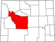 | |
| Towns | ||
| CDPs | ||
| Unincorporated communities | ||
| Ghost town | ||
| Indian reservation | ||