Avedøre railway station
Appearance
| S-train station | |||||||||||
 Avedøre station in 2007 | |||||||||||
| General information | |||||||||||
| Location | 52 Kærgårdsvej 2650 Hvidovre[1] Hvidovre Municipality Denmark | ||||||||||
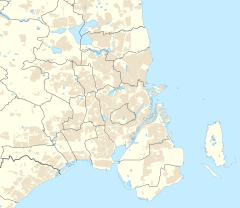
| Coordinates | 55°37′32″N 12°27′18″E / 55.62556°N 12.45500°E | ||||||||||
| Elevation | 5.0 metres (16.4 ft)[2] | ||||||||||
| Owned by | DSB and Banedanmark | ||||||||||
| Line(s) | Køge Bay Line[3] | ||||||||||
| Platforms | 1 island platform | ||||||||||
| Tracks | 2 | ||||||||||
| Train operators | DSB[3] | ||||||||||
| Connections | Bus | ||||||||||
| Other information | |||||||||||
| Station code | Avø[4] | ||||||||||
| Website | Official website | ||||||||||
| History | |||||||||||
| Opened | 1 October 1972[2] | ||||||||||
| Services | |||||||||||
| |||||||||||
| |||||||||||
Avedøre station is a suburban rail railway station serving the suburb of Avedøre southwest of Copenhagen, Denmark.[1]
Avedøre station is located on the Køge radial of Copenhagen's S-train network, a hybrid suburban rail and rapid transit system serving Greater Copenhagen.[3] The station is served regularly by trains on the A-line which have a journey time to central Copenhagen of around 15 minutes.[1]
History
[edit]The station opened on 1 October 1972 as the first section of the Køge Bay Line from Copenhagen to Vallensbæk was completed.[2]

See also
[edit]- List of Copenhagen S-train stations
- List of railway stations in Denmark
- Rail transport in Denmark
- Transport in Copenhagen
- Transport in Denmark
References
[edit]External links
[edit]Wikimedia Commons has media related to Avedøre Station.
- Official website

- (in Danish) Banedanmark – government agency responsible for maintenance and traffic control of most of the Danish railway network
- (in Danish) DSB – the Danish national train operating company
- (in Danish) Danske Jernbaner – website with information on railway history in Denmark


