
Bítouchov
You can help expand this article with text translated from the corresponding article in Czech. (July 2009) Click [show] for important translation instructions.
|
Bítouchov | |
|---|---|
Municipality and village | |
 Common pond in Bítouchov | |
| Country | |
| Region | Central Bohemian Region |
| District | Mladá Boleslav District |
| Area | |
| • Total | 2.74 sq mi (7.09 km2) |
| Population (2006) | |
| • Total | 303 |
| Time zone | UTC+1 (CET) |
| • Summer (DST) | UTC+2 (CEST) |
Bítouchov is a village and municipality in Mladá Boleslav District in the Central Bohemian Region of the Czech Republic. The municipality covers an area of 7.09 km² and as of 2006 it had a population of 303.
Gallery
-
 Local part Dolánky
 -
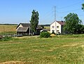
 South part of the village


References
- This article was initially translated from the Czech Wikipedia.
Wikimedia Commons has media related to Bítouchov (Mladá Boleslav District).
50°28′33″N 14°53′22″E / 50.4758°N 14.8894°E