Jump to content

Băcia

Coordinates: 45°48′N 23°01′E / 45.800°N 23.017°E / 45.800; 23.017
From Wikipedia, the free encyclopedia

This is an old revision of this page, as edited by JJMC89 bot (talk | contribs) at 14:24, 14 March 2017 (Migrate {{Infobox settlement}} coordinates parameters to {{Coord}}, see Wikipedia:Coordinates in infoboxes). The present address (URL) is a permanent link to this revision, which may differ significantly from the current revision.

Băcia
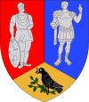
Coat of arms of Băcia
Băcia is located in Romania
Băcia
Băcia
Coordinates: 45°48′N 23°1′E / 45.800°N 23.017°E / 45.800; 23.017
Country Romania
CountyHunedoara County
Population
 (2002)[1]
1,797
Time zoneUTC+2 (EET)
 • Summer (DST)UTC+3 (EEST)

Băcia (Hungarian: Bácsi) is a commune in Hunedoara County, Romania. It is composed of four villages: Băcia, Petreni (Petrény), Tâmpa (Tompa) and Totia (Nagytóti).

References

  1. ^ Romanian census data, 2002 Retrieved on April 8, 2016.

45°48′N 23°01′E / 45.800°N 23.017°E / 45.800; 23.017