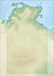
Barranyi (North Island) National Park
Appearance
| Barranyi (North Island) National Park Northern Territory | |
|---|---|
| Nearest town or city | Borroloola |
| Coordinates | 15°35′03″S 136°52′05″E / 15.58417°S 136.86806°E |
| Established | 27 March 1992[1] |
| Area | 53.81 km2 (20.8 sq mi)[1] |
| Managing authorities |
|
| Website | Barranyi (North Island) National Park |
| See also | Protected areas of the Northern Territory |
Barranyi (North Island) National Park is in the Gulf of Carpentaria in the Northern Territory of Australia, 737 km southeast of Darwin.
See also
[edit]References
[edit]- ^ Jump up to: a b c "CAPAD 2012 Northern Territory Summary (see 'DETAIL' tab)". CAPAD 2012. Australian Government - Department of the Environment. 7 February 2014. Retrieved 7 February 2014.
External links
[edit]


