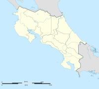
Barva
You can help expand this article with text translated from the corresponding article in Spanish. (February 2009) Click [show] for important translation instructions.
|
Barva | |
|---|---|
Town Seat of the Canton of Barva | |
 | |
| Coordinates: 10°01′N 84°08′W / 10.017°N 84.133°W | |
| Country | |
| Province | Heredia Province |
| Canton | Canton of Barva |
| Area | |
| • Total | 20.8 sq mi (53.8 km2) |
| Population (2001) | |
| • Total | 32,440 |
| Time zone | UTC+0 (GMT) |
| Climate | Am |
Barva is a small city in the Canton of Barva, in Heredia Province, Costa Rica.
Geography
It is located 3 km north of Heredia. It was named in honor of Barvak, an indigenous chief who ruled the area before the arrival of the Spanish.
It is divided into six political districts: Barva, Santa Lucía, San José de la Montaña, San Pedro, San Roque, and San Pablo. The city is known for having a nice mix of rural and metropolitan landscape.
Patron saint
The patron saint of the town is Saint Bartholomew. A large church, Iglesia de San Bartolomé de Barva, was established between 1568 and 1575 is in Barva. Every year on August 24, the people of the town have a celebration dedicated to the saint, and the highlight of the celebration is the unique masquerade, where people go out wearing masks and hit others with cow and pig bladders.
Notable people
External links
 Media related to Barva at Wikimedia Commons
10°01′N 84°08′W / 10.017°N 84.133°W


