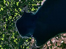
Bay of Lübeck
Appearance

The Bay of Lübeck (Template:Lang-de) is a basin in the southwestern Baltic Sea, off the shores of German states of Mecklenburg-Vorpommern and Schleswig-Holstein. It forms the southwestern part of the Bay of Mecklenburg.
The main port is Travemünde, a borough of the city of Lübeck, at the mouth of river Trave. The Elbe–Lübeck Canal connects the Baltic Sea with the Elbe.
See also
- Priwall Peninsula with the museum ship Passat
- Travemünder Woche - traditional sailing races on the Bay of Lübeck
- The disaster on May 3, 1945, involving these 3 ships:
- Lighthouses and lightvessels in Germany
External links
![]() Media related to Lübecker Bucht at Wikimedia Commons
Media related to Lübecker Bucht at Wikimedia Commons
