Bear Rocks, Pennsylvania
Bear Rocks, Pennsylvania | |
|---|---|
| Coordinates: 40°07′35″N 79°27′54″W / 40.12639°N 79.46500°W | |
| Country | United States |
| State | Pennsylvania |
| County | Fayette |
| Township | Bullskin |
| Area | |
| • Total | 2.65 sq mi (6.86 km2) |
| • Land | 2.65 sq mi (6.86 km2) |
| • Water | 0.0 sq mi (0.0 km2) |
| Elevation | 1,847 ft (563 m) |
| Population (2010) | |
| • Total | 1,048 |
| • Density | 396/sq mi (152.8/km2) |
| Time zone | UTC-5 (Eastern (EST)) |
| • Summer (DST) | UTC-4 (EDT) |
| FIPS code | 42-04616 |
| GNIS feature ID | 2633768 |
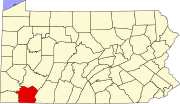
Bear Rocks is an unincorporated community and census-designated place in Bullskin Township, Fayette County, Pennsylvania, United States. Its is located along the south side of Pennsylvania Route 31 in northern Fayette County, on the western slope of Chestnut Ridge. The elevation ranges from 1,150 feet (350 m) above sea level at the northwest end of the community, in the valley of Jacobs Creek, to 2,196 feet (669 m) near the southeast corner of the community, at the intersection of Kreinbrook Hill Road and Sky Top Road. As of the 2010 census the population of the CDP was 1,048.[1]
References
- ^ "Geographic Identifiers: 2010 Census Summary File 1 (G001), Bear Rocks CDP, Pennsylvania". American FactFinder. U.S. Census Bureau. Retrieved July 22, 2016.
External links


