Ben Knowle
Appearance
| Site of Special Scientific Interest | |
 | |
| Location | Somerset |
|---|---|
| Grid reference | ST513450 |
| Coordinates | 51°12′08″N 2°41′54″W / 51.20213°N 2.69843°W |
| Interest | Geological |
| Area | 1.5 hectares (0.015 km2; 0.0058 sq mi) |
| Notification | 1984 |
| Natural England website | |
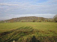
Ben Knowle (grid reference ST513450) is a 1.5 hectare geological Site of Special Scientific Interest in Somerset, notified in 1984.
Ben Knowle is a natural outcrop of Celestine rising from the Somerset Levels where contacts with the host rock, Tea Green Marl, can be seen which illustrate the stratigraphic setting of the mineral deposit.[1]
References
- ^ English Nature citation sheet for the site Archived October 13, 2006, at the Wayback Machine (accessed 7 August 2006)
External links
- English Nature website (SSSI information)

