Bishop's Hull
| Bishop's Hull | |
|---|---|
 | |
 Manor House, Bishop's Hull | |
Location within Somerset | |
| Population | 2,075 [1] |
| OS grid reference | ST202246 |
| District | |
| Shire county | |
| Region | |
| Country | England |
| Sovereign state | United Kingdom |
| Post town | TAUNTON |
| Postcode district | TA1 |
| Dialling code | 01823 |
| Police | Avon and Somerset |
| Fire | Devon and Somerset |
| Ambulance | South Western |
| UK Parliament | |
Bishop's Hull is a village and civil parish in Somerset, England, situated in the western suburbs of Taunton in the Taunton Deane district. It includes the areas of Rumwell, Rumwell Park, Roughmoor and Longaller and is close to the River Tone. The parish, which includes the hamlet of Netherclay, has a population of 2,975 in total.[1]
The A38 and the A3065 pass through it.
At the top of Bishop's Hull Hill there is a post office, a village store and a butcher. The village has one primary school, Bishop's Hull Primary School, which was rebuilt in 1978,[2] and the adjoining nursery called Checkmates.
History
The parish of Hull-Bishop's was part of the Taunton Deane Hundred.[3]
Historically the parish included the castle precincts in the centre of Taunton.[4]
In June 2008, the village celebrated the 400th anniversary of the church bells with a week of events.[5]
Colonel John Farewell (c.1652 - 1710) was a descendant of the Farewell family of Bishop's Hull. Before 1688 he was a soldier in the service of the Netherlands' States General, with the regiment of Thomas Butler, 6th Earl of Ossory. From the ascendancy of William III, he was Deputy, and later Chief Governor and Lieutenant of the Tower of London.[6]
Governance
The parish council has responsibility for local issues, including setting an annual precept (local rate) to cover the council’s operating costs and producing annual accounts for public scrutiny. The parish council evaluates local planning applications and works with the local police, district council officers, and neighbourhood watch groups on matters of crime, security, and traffic. The parish council's role also includes initiating projects for the maintenance and repair of parish facilities, as well as consulting with the district council on the maintenance, repair, and improvement of highways, drainage, footpaths, public transport, and street cleaning. Conservation matters (including trees and listed buildings) and environmental issues are also the responsibility of the council.
The village falls within the Non-metropolitan district of Taunton Deane, which was formed on 1 April 1974 under the Local Government Act 1972, having previously been part of Taunton Rural District.[7] The district council is responsible for local planning and building control, local roads, council housing, environmental health, markets and fairs, refuse collection and recycling, cemeteries and crematoria, leisure services, parks, and tourism.
Somerset County Council is responsible for running the largest and most expensive local services such as education, social services, libraries, main roads, public transport, policing and fire services, trading standards, waste disposal and strategic planning.
It is also part of the Taunton Deane county constituency represented in the House of Commons of the Parliament of the United Kingdom. It elects one Member of Parliament (MP) by the first past the post system of election, and part of the South West England constituency of the European Parliament which elects seven MEPs using the d'Hondt method of party-list proportional representation.
Geography
Netherclay Community Woodland is a woodland with oak, ash, black poplar, dogwood and hazel. It is a local nature reserve.[8]
Landmarks
The manor house dates from 1586, with a mid-19th century addition and internal alterations, and further restoration in 1901.[9]
Hospice
Bishop's Hull is home to St Margaret's Somerset Hospice, which provides palliative care to cancer patients from across the area.
Frank Bond Centre
The Frank Bond Centre, established in 1983, is named after its benefactor, a local builder who had two hobbies: collecting theatre organs and keeping exotic birds. He opened his garden once a year to the general public and all money that was raised went to charity. On his death he left his house and garden (now the Centre) and land to the community.[10] The land was used for development, some for housing and some for the building of St Margaret's Hospice.
Religious sites
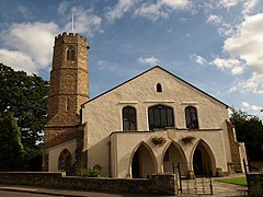
The village has two churches: St Peter and St Paul's Church, on Bishop's Hull Hill, which is a Grade II* listed building dating from the 13th century,[11] and has an octagonal tower and Taunton United Reformed Church, on Bishop's Hull Road.[12]
References
- ^ a b "Statistics for Wards, LSOAs and Parishes — SUMMARY Profiles" (Excel). Somerset Intelligence. Retrieved 4 January 2014.
- ^ "Bishop's Hull Primary School". Bishop's Hull Primary School. Retrieved 18 November 2008.
- ^ "Somerset Hundreds". GENUKI. Retrieved 21 October 2011.
- ^ http://www.visionofbritain.org.uk/place/12969
- ^ "Bells Week: Programme of Events" (PDF). Archived from the original (PDF) on 17 July 2011. Retrieved 6 May 2008.
{{cite web}}: Unknown parameter|deadurl=ignored (|url-status=suggested) (help) - ^ Chancel slab in Ss Peter and Thomas' Church, Stambourne, Essex. Retrieved 17 March 2017
- ^ "Tainton RD". A vision of Britain Through Time. University of Portsmouth. Retrieved 5 January 2014.
- ^ "Netherclay Community Woodland". Natural England. Retrieved 25 August 2015.
- ^ "Manor House". Images of England. English Heritage. Retrieved 18 November 2008.
- ^ "The Frank Bond Community Centre". Bishops Hull Website. Archived from the original on 1 December 2008. Retrieved 18 December 2008.
{{cite web}}: Unknown parameter|deadurl=ignored (|url-status=suggested) (help) - ^ "Church of St Peter and St Paul". Images of England. English Heritage. Retrieved 18 November 2008.
- ^ "United Reformed Church and adjoining Hall to North". Images of England. English Heritage. Retrieved 18 November 2008.


