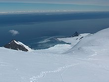
Bransfield Strait

Bransfield Strait (63°0′S 59°0′W / 63.000°S 59.000°W) is a body of water about 60 miles wide extending for 200 miles in a general northeast-southwest direction between the South Shetland Islands and Antarctic Peninsula. It was named in about 1825 by James Weddell, Master, RN, for Edward Bransfield, Master, RN, who charted the South Shetland Islands in 1820. It is called Mar de la Flota by Argentina.
The undersea trough through the strait is known as Bransfield Trough (61°30′S 54°0′W / 61.500°S 54.000°W).
On the 23rd November 2007, the MS Explorer struck an iceberg and sank in the Bransfield Strait. All 154 passengers were rescued. No injuries were reported.
![]() This article incorporates public domain material from "Bransfield Strait". Geographic Names Information System. United States Geological Survey.
This article incorporates public domain material from "Bransfield Strait". Geographic Names Information System. United States Geological Survey.
