Branston Water Park
| Branston Water Park | |
|---|---|
 Looking across the lake | |
| Location | Burton upon Trent |
| OS grid | SK 215 208 |
| Coordinates | 52°47′4″N 1°41′2″W / 52.78444°N 1.68389°W |
| Area | 23.55 hectares (58.2 acres) |
| Designation | Local nature reserve |
| Website | Branston Water Park |
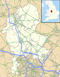
Branston Water Park is a local nature reserve near Burton upon Trent, in Staffordshire, England, adjacent to the village of Branston.
History
[edit]The lake is a former gravel pit, one of several along the Trent Valley. There was gravel extraction here from the 1930s to the 1950s, after which wildlife habitats developed naturally. In the mid 1980s the land was leased by East Staffordshire Borough Council; public access was introduced, and the site was developed as a country park, with pathways, signage and a visitor centre.[1]
The reserve was designated a local nature reserve (LNR) in 2010. As of 2020[update], it has held the Green Flag Award since 2005.[1][2]
Description
[edit]The Trent and Mersey Canal passes alongside the site to the north-west; to the south- east is the A38 road.
Its area is 23.55 hectares (58.2 acres).[3] It is a notable wetland site, and around the lake is woodland, predominantly of willow and birch, and wildflower meadow. There is a large reed bed, which is a Grade 1 Staffordshire Site of Biological Importance.[1]
There is a flat circular path around the lake, and there are picnic areas and a children's play area. The Burton Mutual Angling Association and the Burton Model Boating Club use the park by agreement with East Staffordshire Borough Council.[1]
References
[edit]- ^ a b c d "Branston Water Park: Management Plan 2018–2021" East Staffordshire Borough Council. Retrieved 10 July 2020.
- ^ "Branston Water Park" East Staffordshire Borough Council. Retrieved 9 July 2020.
- ^ "Branston Water Park LNR" Natural England. Retrieved 10 July 2020.

