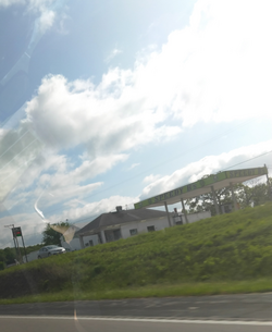
Brazito, Missouri
Appearance
Brazito | |
|---|---|
 Brazito in May 2024 | |
| Coordinates: 38°26′44″N 92°18′10″W / 38.44556°N 92.30278°W | |
| Country | |
| U.S. State | Missouri |
| County | Cole County |
| Laid out | 1850 |
| Named for | Battle of El Brazito |
| ZIP code | 65109 |
Brazito is an unincorporated community in Cole County, in the U.S. state of Missouri.[1]
The community is approximately ten miles southwest of Jefferson City along U.S. Route 54.[2] It borrows its ZIP Code, 65109, from Jefferson City. The area code is also used by Elston and St. Martins.[3]
History
[edit]Brazito was laid out in 1850, and named in commemoration of the Battle of El Brazito in the Mexican–American War.[4] A post office called Brazito was established in 1856, and remained in operation until 1930.[5]
References
[edit]- ^ U.S. Geological Survey Geographic Names Information System: Brazito, Missouri
- ^ Missouri Atlas & Gazetteer, 1998, Delorme pp. 37-8 ISBN 0-89933-224-2
- ^ "Brazito, Missouri Zip Codes for 2020, 2019". suburbanstats.org. Archived from the original on May 6, 2024. Retrieved May 6, 2024.
- ^ "Cole County Place Names, 1928–1945 (archived)". The State Historical Society of Missouri. Archived from the original on June 24, 2016. Retrieved September 22, 2016.
{{cite web}}: CS1 maint: bot: original URL status unknown (link) - ^ "Post Offices". Jim Forte Postal History. Archived from the original on March 6, 2016. Retrieved September 22, 2016.


