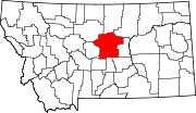
Buffalo, Montana
Appearance
Buffalo is an unincorporated rural hamlet in Fergus County, Montana, United States. Buffalo has a church, a post office serving ZIP code 59418, no other businesses or services, and only perhaps half a dozen homes.[1] It was named for the buffalo which roamed this area.[2]
The post office was established in 1890.[3] It closed for several years until the Great Northern Railroad created a line to Billings with Buffalo as a station.[2]
Buffalo is bordered by Lewis and Clark National Forest. It is located between the Little Belt Mountains and the Big Snowy Mountains.
Climate
[edit]The Köppen Climate System classifies the weather as humid continental, abbreviated as Dfb.[4]
| Climate data for Buffalo, Montana | |||||||||||||
|---|---|---|---|---|---|---|---|---|---|---|---|---|---|
| Month | Jan | Feb | Mar | Apr | May | Jun | Jul | Aug | Sep | Oct | Nov | Dec | Year |
| Mean daily maximum °C (°F) | −3 (26) |
2 (35) |
2 (36) |
10 (50) |
17 (62) |
21 (69) |
27 (81) |
26 (79) |
20 (68) |
14 (57) |
7 (44) |
2 (36) |
12 (54) |
| Mean daily minimum °C (°F) | −16 (4) |
−10 (14) |
−9 (15) |
−3 (26) |
3 (37) |
6 (43) |
10 (50) |
9 (49) |
4 (40) |
0 (32) |
−6 (22) |
−9 (15) |
−2 (29) |
| Average precipitation mm (inches) | 28 (1.1) |
20 (0.8) |
36 (1.4) |
53 (2.1) |
94 (3.7) |
100 (4) |
58 (2.3) |
56 (2.2) |
53 (2.1) |
41 (1.6) |
28 (1.1) |
28 (1.1) |
600 (23.6) |
| Source: Weatherbase [5] | |||||||||||||
References
[edit]- ^ USPS – Cities by ZIP Code Archived June 15, 2011, at the Wayback Machine
- ^ a b Carkeek Cheney, Roberta (1983). Names on the Face of Montana. Missoula, Montana: Mountain Press Publishing Company. ISBN 0-87842-150-5.
- ^ "Montana Place Names Companion". Montana Historical Society. Retrieved July 29, 2017.
- ^ Climate Summary for Buffalo, Montana
- ^ "Weatherbase.com". Weatherbase. 2013. Retrieved on September 5, 2013.
External links
[edit]- Buffalo – Central Montana
- U.S. Geological Survey Geographic Names Information System: Buffalo, Montana
46°49′16″N 109°49′43″W / 46.82111°N 109.82861°W

