Burgumer Mar
Appearance
| Burgumer Mar Bergumermeer | |
|---|---|
 | |
| Location | Friesland |
| Coordinates | 53°11′30″N 6°02′30″E / 53.19167°N 6.04167°E |
| Basin countries | Netherlands |
| Surface area | 360 ha (890 acres) |
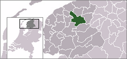
The Burgumer Mar (Dutch: Bergumermeer) is a lake near the town of Burgum in the Dutch province of Friesland. The lake was formed during the last ice age. It is a popular water sports area with multiple yacht harbours. The Princess Margriet Canal splits the lake into a northern and southern part.
Since March 15, 2007 the West Frisian name Burgumer Mar is the official name; before that date the Dutch name was the official one[1]). The villages Jistrum, Eastermar and Sumar together with Burgum border the lake.
References
- ^ Waternamen in Fryslân Archived September 27, 2007, at the Wayback Machine

