Caldermill
Appearance
| Caldermill | |
|---|---|
Location within South Lanarkshire | |
| OS grid reference | NS6641 |
| Council area | |
| Country | Scotland |
| Sovereign state | United Kingdom |
| Post town | STRATHAVEN |
| Postcode district | ML10 |
| Dialling code | 01357 440 |
| Police | Scotland |
| Fire | Scottish |
| Ambulance | Scottish |
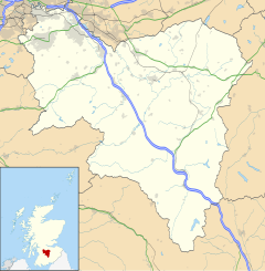
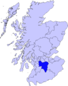
Caldermill is a hamlet in South Lanarkshire, Scotland.
Caldermill is a few miles west of Strathaven and is the next settlement a driver will come across after leaving Strathaven on the A71 west-bound towards Kilmarnock. Caldermill is a hamlet of just a few houses, but has history linked with that of the covenanters. For children raised in Caldermill, the closest primary school is Gilmourton Primary, in the nearby hamlet of Drumclog, which is a few miles further along the A71 towards Kilmarnock, the nearest high school being Strathaven Academy, located in the town of Strathaven.


