Calvillo Municipality
Calvillo | |
|---|---|
 Municipal Palace | |
 Municipality location in Aguascalientes | |
| Coordinates: 21°51′N 102°43′W / 21.850°N 102.717°W | |
| Country | Mexico |
| State | Aguascalientes |
| Municipal seat | Calvillo |
| Area | |
• Total | 931.62 km2 (359.70 sq mi) |
| Population (2015) | |
• Total | 56,048 |
| • Density | 60/km2 (160/sq mi) |
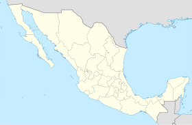
Calvillo (Spanish: [kalˈβiʝo] ⓘ) is a municipality in the Mexican state of Aguascalientes. The city of Calvillo, the second largest in the state, serves as the municipal seat. It is located to the western part of the state, at about 52 kilometers of the city of Aguascalientes. It stands at 21°51′N 102°43′W / 21.850°N 102.717°W in the southwestern corner of the state. It is bounded by Jalisco and Zacatecas. The municipality, which has an area of 931.26 km² (359.56 sq mi), reported a population of 54,136 by 2010. The town of Ojocaliente is another significant community in the municipality. Calvillo is one of the richest, most prosperous municipalities in Aguascalientes.
During the French invasion of Mexico, the north part of the valley of Huajuacar in which Calvillo lays, was occupied by the French. At the time, they intermixed with the descendants of Spaniards which already inhabited the south part of the valley. This fact made Calvillo the municipality with most Caucasian-origin inhabitants in the state, compared with the other municipalities.
Calvillo is the largest guava producer in Mexico and famous for its superb confectionery and liqueurs made from this fruit, which you can sample at the Guava Fair held during the first week of December.
The economy in Calvillo is centered on the guava, although there is other agriculture and a great deal of commerce. Calvillo is better known as the world capital of the guava.
Demographics
[edit]| Year | Pop. | ±% |
|---|---|---|
| 2010 | 54,136 | — |
| 2015 | 56,048 | +3.5% |
| 2020 | 58,250 | +3.9% |
| [1][2][3][4] | ||
As of 2010, the municipality had a total population of 54,136,[5]
As of 2010, the city of Calvillo had a population of 19,742.[5] Other than the city of Calvillo, the municipality had 307 localities, the largest of which (with 2010 populations in parentheses) were: Ojocaliente (6,914), classified as urban, and El Cuervero (Cuerveros) (2,350), Valle Huejúcar (Fraccionamiento Popular) (1,991), La Labor (1,988), Malpaso (1,697), San Tadeo (1,507), Chiquihuitero (San Isidro) (1,318), La Panadera (1,212), Mesa Grande (1,149), Jaltiche de Arriba (1,114), and Crucero las Pilas (1,031), classified as rural.[5]
References
[edit]- ^ "Localidades y su población por municipio según tamaño de localidad" (PDF) (in Spanish). INEGI. Archived from the original (PDF) on 31 August 2018. Retrieved 15 July 2017.
- ^ "Número de habitantes". INEGI (National Institute of Statistics and Geography). Archived from the original on 2 July 2017. Retrieved 15 July 2017.
- ^ "Tabulados de la Encuesta Intercensal 2015" (xls) (in Spanish). INEGI. Archived from the original on 31 December 2017. Retrieved 15 July 2017.
- ^ "INEGI. Censo de Población y Vivienda 2020. Tabulados del Cuestionario Básico – Aguascalientes" [INEGI. 2020 Population and Housing Census. Basic Questionnaire Tabulations – Aguascalientes] (Excel) (in Spanish). INEGI. 2020. pp. 1–4. Archived from the original on 28 January 2021. Retrieved 27 January 2021.
- ^ a b c "Calvillo". Catálogo de Localidades. Secretaría de Desarrollo Social (SEDESOL). Archived from the original on 4 March 2016. Retrieved 23 April 2014.
- Link to tables of population data from Census of 2005 Instituto Nacional de Estadística, Geografía e Informática (INEGI)
- Aguascalientes Enciclopedia de los Municipios de México
- Spanish version of the history of Calvillo
External links
[edit]- Ayuntamiento de Calvillo Official website
- http://calvillo.blogspot.com
- https://web.archive.org/web/20190121024015/https://calvillo.com.mx/
- http://calvillo.sdmexico.com
- Gobierno del Estado de Aguascalientes Official website of State of Aguascalientes
- http://www.calvilloweb.com
- https://web.archive.org/web/20081121201222/http://www.livevideo.com/liveshow/calvillo
- http://www.myspace.com/calvisranch


