Cardross, Victoria
| Cardross Victoria | |||||||||||||||
|---|---|---|---|---|---|---|---|---|---|---|---|---|---|---|---|
 Cardross General Store | |||||||||||||||
| Coordinates | 34°18′S 142°09′E / 34.300°S 142.150°E | ||||||||||||||
| Population | 821 (2016 census)[1] | ||||||||||||||
| Postcode(s) | 3496 | ||||||||||||||
| Location |
| ||||||||||||||
| LGA(s) | Rural City of Mildura | ||||||||||||||
| Region | Sunraysia | ||||||||||||||
| State electorate(s) | Mildura | ||||||||||||||
| Federal division(s) | Division of Mallee | ||||||||||||||
| |||||||||||||||
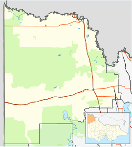
Cardross is a small town approximately 15 km south east of Mildura, in north western Victoria, Australia. At the 2016 census, Cardross and the surrounding area had a population of 821.[1] It was the site of a road fatality in February 2006, in which six teenagers were killed in a hit-run accident.
Cardross named after the Scottish village was established as a farming community in the 1920s, the Post Office opening on 15 June 1925.[2]
Cardross has an Australian Rules football team competing in the Millewa Football League.

References
- ^ a b Australian Bureau of Statistics (27 June 2017). "Cardross (State Suburb)". 2016 Census QuickStats. Retrieved 31 December 2017.
- ^ Premier Postal History, Post Office List, retrieved 11 April 2008
See also


