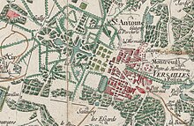
Cassini map

The Cassini map is the first general map of the Kingdom of France.
It was on a scale of one line to 100 toises, i.e. 1/86,400.
See also
You can help expand this article with text translated from the corresponding article in French. (March 2015) Click [show] for important translation instructions.
|
