Cessna, Pennsylvania
Appearance
This article needs additional citations for verification. (January 2016) |
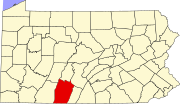
Cessna is a populated place in Bedford County, Pennsylvania, United States, located within Bedford Township.[1] Its elevation is at 1,102 feet above sea level.[2]
The place is notable for being the birthplace of John Cessna. It is at the confluence of Interstate 99 and Pennsylvania Route 56.
References
- ^ "Cessna, PA - Cessna, Pennsylvania Map & Directions". MapQuest.com. Retrieved 2016-01-07.
- ^ "Cessna Populated Place Profile / Bedford County, Pennsylvania Data". Pennsylvania.hometownlocator.com. Retrieved 2016-01-07.

