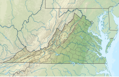
Coleman Falls Dam
Appearance
| Coleman Falls Dam | |
|---|---|
| Location | Bedford County, Virginia / Amherst County, Virginia, U.S. |
| Coordinates | 37°30′8.55″N 79°17′59.90″W / 37.5023750°N 79.2999722°W |
| Purpose | Hydroelectric, Recreation, Fish and Wildlife Pond |
| Status | In use |
| Opening date | 1851 |
| Owner(s) | Georgia Pacific Corporation |
| Operator(s) | Georgia Pacific Corporation |
| Dam and spillways | |
| Type of dam | Gravity |
| Impounds | James River |
| Height | 20 ft (6.1 m) |
| Length | 562 ft (171 m) |
| Power Station | |
| Operator(s) | Georgia Pacific Corporation |
| Hydraulic head | 18 ft (5.5 m) |
The Coleman Falls Dam is a hydroelectric generation facility on the James River near the community of Coleman Falls, Virginia. The project includes a gravity dam spanning the left side of river and a power house on the right bank which contain hydroelectric generation equipment.[1][2]
The dam is located upstream of the smaller Holcomb Rock Dam.

