
Countyline, Oklahoma
Countyline, Oklahoma | |
|---|---|
 Countyline Location within the state of Oklahoma  Countyline Countyline (the United States) | |
| Coordinates: 34°26′55″N 97°33′46″W / 34.44861°N 97.56278°W | |
| Country | United States |
| State | Oklahoma |
| County | Carter and Stephens |
| Time zone | UTC-6 (Central (CST)) |
| • Summer (DST) | UTC-5 (CDT) |
| ZIP codes | 73425 |
| GNIS feature ID | 1091753 |
Countyline, or County Line, is a rural unincorporated community on the Stephens-Carter county line in south central Oklahoma.[1] It is north of State Highway 7. The post office opened June 29, 1928.[2] The ZIP Code is 73425.
References
- ^ U.S. Geological Survey Geographic Names Information System: Countyline, Oklahoma
- ^ Shirk, George H. Oklahoma Place Names, Norman, Oklahoma: University of Oklahoma Press, 1965, p.55.
Municipalities and communities of Carter County, Oklahoma, United States | ||
|---|---|---|
| Cities |  | |
| Towns | ||
| CDP | ||
| Other communities | ||
| Ghost towns | ||
| Indian reservation | ||
| Footnotes | ‡This populated place also has portions in an adjacent county or counties | |
Municipalities and communities of Stephens County, Oklahoma, United States | ||
|---|---|---|
| Cities | 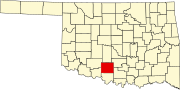 | |
| Towns | ||
| CDP | ||
| Other communities | ||
| Ghost town | ||
| Indian reservation | ||
| Footnotes | ‡This populated place also has portions in an adjacent county or counties | |
This Oklahoma state location article is a stub. You can help Wikipedia by expanding it. |