
Czarna Woda
Czarna Woda | |
|---|---|
 Coat of arms | |
 Czarna Woda | |
| Coordinates: 53°50′N 18°6′E / 53.833°N 18.100°E | |
| Country | |
| Voivodeship | Pomeranian |
| County | Starogard |
| Gmina | Czarna Woda (urban gmina) |
| Area | |
| • Total | 27.75 km2 (10.71 sq mi) |
| Population (2006) | |
| • Total | 3,182 |
| • Density | 110/km2 (300/sq mi) |
| Postal code | 83-262 |
| Website | http://www.czarna-woda.pl |
Czarna Woda [ˈt͡ʂarna ˈvɔda] (German: Schwarzwasser) is a town in Starogard County, Pomeranian Voivodeship, Poland, with 3,223 inhabitants (2004).
Gallery
-
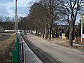 Mickiewicza Street in Czarna Woda
 -
 Mickiewicza Street in Czarna Woda
 -
 Starogardzka Street
 -
 Railway Station


| Urban gminas |
|  |
|---|---|---|
| Urban-rural gmina | ||
| Rural gminas | ||
53°50′N 18°06′E / 53.833°N 18.100°E
This Pomeranian Voivodeship location article is a stub. You can help Wikipedia by expanding it. |