Darabani
Appearance
Darabani | |
|---|---|
Town | |
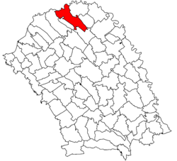
 Location of Darabani | |
| Coordinates: 48°11′11″N 26°35′21″E / 48.18639°N 26.58917°E | |
| Country | |
| County | Botoșani County |
| Status | Town |
| Government | |
| • Mayor | Corneliu Arosoaie (Social Democratic Party) |
| Area | |
| • Total | 99.85 km2 (38.55 sq mi) |
| Population (2011) | |
| • Total | 9,893 |
| Time zone | UTC+2 (EET) |
| • Summer (DST) | UTC+3 (EEST) |
Darabani (Romanian pronunciation: [daraˈbanʲ]) is a town in Botoșani County, Moldavia, Romania, and is the northernmost town in Romania. It administers three villages: Bajura, Eșanca and Lișmănița.
| Year | Pop. | ±% |
|---|---|---|
| 1930 | 10,748 | — |
| 1948 | 11,379 | +5.9% |
| 1977 | 10,880 | −4.4% |
| 1992 | 11,804 | +8.5% |
| 2002 | 12,002 | +1.7% |
| 2011 | 9,893 | −17.6% |
| Source: Census data | ||
Wikimedia Commons has media related to Darabani.


