Jump to content

Droop Hill

Coordinates: 56°55′27″N 2°24′09″W / 56.9241°N 2.4026°W / 56.9241; -2.4026
From Wikipedia, the free encyclopedia

This is an old revision of this page, as edited by InternetArchiveBot (talk | contribs) at 05:11, 14 September 2017 (Rescuing 1 sources and tagging 0 as dead. #IABot (v1.5.2)). The present address (URL) is a permanent link to this revision, which may differ significantly from the current revision.

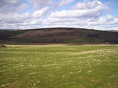
Droop Hill, Aberdeenshire. Courtesy: Dominic Dawn Harry and Jacob Paterson

Droop Hill is a mountain landform in the Kincardine and Mearns region of Aberdeenshire, Scotland.[1] The locale had been featured in a windfarm proposal submitted to the Aberdeenshire Council.[2]

See also

References

Northeast gentle slopes of Droop Hill. Courtesy: C.Michael Hogan
  • United Kingdom Ordnance Survey Map Landranger 45, Stonehaven and Banchory, 1:50,000 scale, 2004
  • Droop Hill wind farm proposal (2006) APP/2006/3278, Aberdeenshire Council [1]

Line notes

  1. ^ Ordnance Survey, 2004
  2. ^ Droop Hill, 2006

56°55′27″N 2°24′09″W / 56.9241°N 2.4026°W / 56.9241; -2.4026