
Dähre
Dähre | |
|---|---|
Location of Dähre within Altmarkkreis Salzwedel district 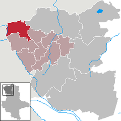 | |
 Dähre  Dähre | |
| Coordinates: 52°48′2″N 10°54′32″E / 52.80056°N 10.90889°E | |
| Country | Germany |
| State | Saxony-Anhalt |
| District | Altmarkkreis Salzwedel |
| Municipal assoc. | Beetzendorf-Diesdorf |
| Government | |
| • Mayor (2023–30) | Bernd Hane[1] (CDU) |
| Area | |
• Total | 78.73 km2 (30.40 sq mi) |
| Elevation | 53 m (174 ft) |
| Population (2022-12-31)[2] | |
• Total | 1,411 |
| • Density | 18/km2 (46/sq mi) |
| Time zone | UTC+01:00 (CET) |
| • Summer (DST) | UTC+02:00 (CEST) |
| Postal codes | 29413 |
| Dialling codes | 039031 |
| Vehicle registration | SAW |
| Website | www.beetzendorf-diesdorf.de |
Dähre is a municipality in the district Altmarkkreis Salzwedel, in Saxony-Anhalt, Germany. A section of the Salzwedeler Dumme river flows through it. Since 2009 it has incorporated the former municipalities of Bonese and Lagendorf.[3]
References
[edit]- ^ Bürgermeisterwahlen in den Gemeinden, Endgültige Ergebnisse, Statistisches Landesamt Sachsen-Anhalt. Retrieved 10 July 2024.
- ^ "Bevölkerung der Gemeinden – Stand: 31. Dezember 2022" (PDF) (in German). Statistisches Landesamt Sachsen-Anhalt. June 2023.
- ^ Gebietsänderungen am 01.01.2009, Statistisches Bundesamt
Towns and municipalities in Altmarkkreis Salzwedel | ||
|---|---|---|
| International | |
|---|---|
| National | |
This Altmarkkreis Salzwedel location article is a stub. You can help Wikipedia by expanding it. |