Ellé
Appearance
| Ellé | |
|---|---|
 | |
| Physical characteristics | |
| Mouth | Laïta 47°52′15″N 3°32′43″W / 47.87083°N 3.54528°W |
| Length | 59 km |
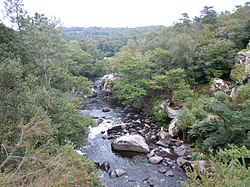
The Ellé is a river in the region of Brittany, western France. Its source is south of the town Rostrenen, in the south-west of the department Côtes-d'Armor. The Ellé flows southwest through the following départements and towns:
At the town of Quimperlé it is joined by the Isole to form the Laïta that flows into the Atlantic Ocean at Le Pouldu.
