
Ellingråsa Lighthouse
 | |
| Location | Bjørøya Island Nord-Trøndelag Norway |
|---|---|
| Coordinates | 64°34′28″N 10°48′04″E / 64.5744°N 10.8011°E |
| Tower | |
| Constructed | 1888 (first) |
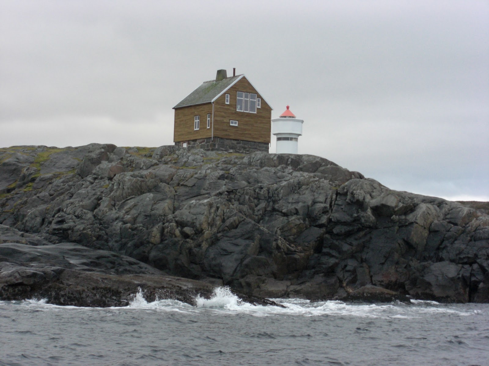
| Construction | stone and wooden keeper's house (first) |
| Automated | 1959 |
| Height | 5.7 metres (19 ft) |
| Shape | cylindrical tower with balcony and lantern (current) |
| Markings | white house, the light shown through the window (first) white tower, red lantern (current) |
| Operator | Ellingråsa Lighthouse Lodge[1] |
| Light | |
| First lit | 2001 (current) |
| Deactivated | 2001 (first) |
| Focal height | 22.5 metres (74 ft) |
| Range | 14.5 nmi (26.9 km; 16.7 mi) |
| Characteristic | Fl (2) WRG 5s. |
| Norway no. | NF-5091 |
Ellingråsa Lighthouse is a lighthouse that is located on the island of Bjørøya in the Folda sea in the municipality of Flatanger in Nord-Trøndelag county, Norway. The 22.5-metre (74 ft) tall light can be seen from about 14.5 nmi (26.9 km; 16.7 mi) away.[2] The lighthouse was completed in 1888 to replace the old Villa Lighthouse which closed in 1890. Ellingråsa Lighthouse was automated in 1959.[3] Its lighting sequence is white, red or green lights, flashing twice every five seconds.
See also
References
- ^ Rowlett, Russ. "Lighthouses of Norway: Northern Trøndelag". The Lighthouse Directory. University of North Carolina at Chapel Hill. Retrieved February 28, 2016.
- ^ Kystverket (2008). Norske Fyrliste 2008 (PDF) (in Norwegian). ISBN 978-82-450-0628-5.
- ^ "Ellingråsa" (in Norwegian). Fyr.no. Retrieved 2011-08-16.
External links
This Norwegian lighthouse-related article is a stub. You can help Wikipedia by expanding it. |