
Hurricane, Mississippi
Esperanza | |
|---|---|
 Esperanza Esperanza's position in Mississippi. | |
| Coordinates: 34°21′28″N 89°09′39″W / 34.35778°N 89.16083°W | |
| Country | |
| State | |
| County | Pontotoc |
| Elevation | 111 m (364 ft) |
| Time zone | UTC-6 (Central (CST)) |
| • Summer (DST) | UTC-5 (CDT) |
| GNIS feature ID | 693184 |
| U.S. Geological Survey Geographic Names Information System: Hurricane, Mississippi | |
Esperanza is an unincorporated community in Pontotoc County, Mississippi, United States.[1] On April 27, 2011, a tornado touched down in the Esperanza area as part of the 2011 Super Outbreak, but apparently caused no damage.[2]
References
- ^ "Feature Detail Report for: Esperanza, Mississippi." USGS. U.S. Geological Survey Geographic Names Information System: Hurricane, Mississippi Retrieved April 28, 2011.
- ^ NOAA Report
Municipalities and communities of Pontotoc County, Mississippi, United States | ||
|---|---|---|
| City | 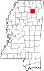 | |
| Towns | ||
| CDP | ||
| Other communities | ||
| Footnotes | ‡This populated place also has portions in an adjacent county or counties | |
This Mississippi location article is a stub. You can help Wikipedia by expanding it. |