
Eure, North Carolina
Eure, North Carolina | |
|---|---|
 Eure | |
| Coordinates: 36°25′39″N 76°51′12″W / 36.42750°N 76.85333°W | |
| Country | United States |
| State | North Carolina |
| County | Gates |
| Elevation | 23 ft (7 m) |
| Time zone | UTC-5 (Eastern (EST)) |
| • Summer (DST) | UTC-4 (EDT) |
| GNIS feature ID | 1025312 |
Eure is an unincorporated community in mid-western Gates County, North Carolina. It lies at an elevation of 23 feet (7 m).[1]
References
Municipalities and communities of Gates County, North Carolina, United States | ||
|---|---|---|
| Town | 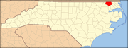 | |
| CDP | ||
| Unincorporated communities | ||