Fagaliʻi Airport
Fagali'i Airport | |||||||||||
|---|---|---|---|---|---|---|---|---|---|---|---|
 | |||||||||||
| Summary | |||||||||||
| Airport type | Public | ||||||||||
| Operator | Samoa Airport Authority | ||||||||||
| Serves | Apia | ||||||||||
| Location | Fagali'i-Uta | ||||||||||
| Coordinates | 13°50′54″S 171°44′30″W / 13.84833°S 171.74167°W | ||||||||||
| Map | |||||||||||
 | |||||||||||
| Runways | |||||||||||
| |||||||||||
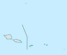
Fagali'i Airport (IATA: FGI, ICAO: NSFI) is an airport located Fagali'i, Samoa.
History
Fagali'i Airport was previously owned and operated by Polynesian Airlines and the Samoan Government. Fagali'i airstrip - at one time a grass-only airstrip, was paved and reopened on the 6th of July 2002,[1] only to be de-commissioned in Jan 2005 due to Government and village concerns over safety and noise.
On 1 July 2009, Polynesian Airlines reopened Fagali'i airport and resumed a service that included international flights to Pago Pago, American Samoa.[2] The reopening of the airport was controversial and attracted criticism both for the safety and environmental issues with the airport's configuration and for the potential burden on local communities should the scheme fail.[3]
Airlines that have operated from the airport include:
Airlines and destinations
| Airlines | Destinations |
|---|---|
| Polynesian Airlines | Pago Pago |
| Samoa Air | Asau, Maota, Pago Pago |
| Talofa Airways | Pago Pago |
References
- ^ Polynesian Whispers 2002
- ^ Sagapolutele, Fili. "Polynesian to resume flying into Fagali'i airport this week". Samoa News. SamoaNews.com. Retrieved 11 June 2011.
- ^ Samoa Observer 23 November 2008

