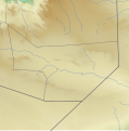
File:Sool location relief map.svg
Appearance

Size of this PNG preview of this SVG file: 585 × 592 pixels. Other resolutions: 237 × 240 pixels | 474 × 480 pixels | 759 × 768 pixels | 1,012 × 1,024 pixels | 2,024 × 2,048 pixels.
Original file (SVG file, nominally 585 × 592 pixels, file size: 784 KB)
File history
Click on a date/time to view the file as it appeared at that time.
| Date/Time | Thumbnail | Dimensions | User | Comment | |
|---|---|---|---|---|---|
| current | 21:28, 2 January 2023 |  | 585 × 592 (784 KB) | Freetrashbox | Reverted to version as of 20:44, 1 January 2023 (UTC) See File talk:Sanaag location relief map.svg |
| 03:36, 2 January 2023 |  | 585 × 592 (790 KB) | Siirski | Reverted to version as of 20:49, 31 December 2022 (UTC) *Regional border of Somaliland: SOMALILAND VULNERABILITY INDEX MAP / {{Cite web |author=Ministry of Planning and National Development of Somaliland |date= |url=https://mopnd.govsomaliland.org/site/downloadfile/file/MjAyMS8wNy8yMDIxLTA3LTA0LTA5LTEzLTQ3LTgtMTYyNTQzMzIyNy5wZGY%3D|title=SOMALILAND VULNERABILITY INDEX MAP |accessdate=2022-12-13}} | |
| 20:44, 1 January 2023 |  | 585 × 592 (784 KB) | Freetrashbox | Reverted to version as of 11:50, 20 December 2022 (UTC) No source | |
| 20:49, 31 December 2022 |  | 585 × 592 (790 KB) | Siirski | Corrected eastern border | |
| 11:50, 20 December 2022 |  | 585 × 592 (784 KB) | Freetrashbox | Uploaded a work by Assemblied by User:Freetrashbox from ETOPO Global Relief Model with UploadWizard |
File usage
The following 14 pages use this file:
Global file usage
The following other wikis use this file:
- Usage on fr.wikipedia.org
- Usage on si.wikipedia.org
- Usage on uz.wikipedia.org

