
Flaxton, North Dakota
Flaxton, North Dakota | |
|---|---|
 Location of Flaxton, North Dakota | |
| Country | United States |
| State | North Dakota |
| County | Burke |
| Area | |
| • Total | 0.3 sq mi (0.7 km2) |
| • Land | 0.3 sq mi (0.7 km2) |
| • Water | 0.0 sq mi (0.0 km2) |
| Elevation | 1,939 ft (591 m) |
| Population (2000) | |
| • Total | 73 |
| • Density | 258.8/sq mi (99.9/km2) |
| Time zone | UTC-6 (Central (CST)) |
| • Summer (DST) | UTC-5 (CDT) |
| ZIP code | 58737 |
| Area code | 701 |
| FIPS code | 38-26700Template:GR |
| GNIS feature ID | 1028986Template:GR |
Flaxton is a city in Burke County, North Dakota in the United States. The population was 73 at the 2000 census. Flaxton was founded in 1900 and was named because the predominant crop in the area is flax.
Geography
Flaxton is located at 48°53′53″N 102°23′38″W / 48.89806°N 102.39389°WInvalid arguments have been passed to the {{#coordinates:}} function (48.897932, -102.393956)Template:GR.
According to the United States Census Bureau, the city has a total area of 0.3 square miles (0.7 km²), all of it land.
Demographics
As of the censusTemplate:GR of 2000, there were 73 people, 40 households, and 19 families residing in the city. The population density was 258.8 people per square mile (100.7/km²). There were 77 housing units at an average density of 273.0/sq mi (106.2/km²). The racial makeup of the city was 100.00% White.
There were 40 households out of which 15.0% had children under the age of 18 living with them, 37.5% were married couples living together, 7.5% had a female householder with no husband present, and 52.5% were non-families. 50.0% of all households were made up of individuals and 25.0% had someone living alone who was 65 years of age or older. The average household size was 1.83 and the average family size was 2.58.
In the city the population was spread out with 21.9% under the age of 18, 20.5% from 25 to 44, 28.8% from 45 to 64, and 28.8% who were 65 years of age or older. The median age was 53 years. For every 100 females there were 108.6 males. For every 100 females age 18 and over, there were 111.1 males.
The median income for a household in the city was $13,571, and the median income for a family was $21,250. Males had a median income of $28,250 versus $11,250 for females. The per capita income for the city was $8,264. There were 50.0% of families and 53.3% of the population living below the poverty line, including 76.0% of under eighteens and 38.5% of those over 64.
References
External links
Municipalities and communities of Burke County, North Dakota, United States | ||
|---|---|---|
| Cities | 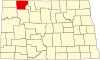 | |
| Townships | ||
| Unorganized territory | ||
| CDP | ||
| Other communities | ||
| Indian reservation | ||
| Footnotes | ‡This populated place also has portions in an adjacent county or counties | |