
Fruithurst, Alabama
Fruithurst, Alabama | |
|---|---|
Town | |
 | |
 Location of Fruithurst in Cleburne County, Alabama. | |
| Coordinates: 33°43′51″N 85°25′54″W / 33.73083°N 85.43167°W | |
| Country | United States |
| State | Alabama |
| County | Cleburne |
| Area | |
| • Total | 1.00 sq mi (2.59 km2) |
| • Land | 1.00 sq mi (2.59 km2) |
| • Water | 0.00 sq mi (0.00 km2) |
| Elevation | 1,079 ft (329 m) |
| Population (2010) | |
| • Total | 284 |
| • Estimate (2016)[2] | 280 |
| • Density | 280.00/sq mi (108.08/km2) |
| Time zone | UTC-6 (Central (CST)) |
| • Summer (DST) | UTC-5 (CDT) |
| ZIP code | 36262 |
| Area code | 256 |
| FIPS code | 01-28432 |
| GNIS feature ID | 0118739 |
Fruithurst is a town in Cleburne County, Alabama, United States. At the 2010 census the population was 284.[3]
Geography
Fruithurst is located at 33°43'51.971" North, 85°25'54.332" West (33.731103, -85.431759).[4]
According to the U.S. Census Bureau, the city has a total area of 1.0 square mile (2.6 km2), all land.
Demographics
| Census | Pop. | Note | %± |
|---|---|---|---|
| 1900 | 374 | — | |
| 1910 | 257 | −31.3% | |
| 1920 | 223 | −13.2% | |
| 1930 | 225 | 0.9% | |
| 1940 | 281 | 24.9% | |
| 1950 | 318 | 13.2% | |
| 1960 | 255 | −19.8% | |
| 1970 | 229 | −10.2% | |
| 1980 | 239 | 4.4% | |
| 1990 | 177 | −25.9% | |
| 2000 | 270 | 52.5% | |
| 2010 | 284 | 5.2% | |
| 2016 (est.) | 280 | [2] | −1.4% |
| U.S. Decennial Census[5] 2013 Estimate[6] | |||
As of the census[7] of 2000, there were 270 people, 107 households, and 74 families residing in the city. The population density was 264.8 people per square mile (102.2/km²). There were 111 housing units at an average density of 108.9 per square mile (42.0/km²). The racial makeup of the city was 99.63% White and 0.37% Black or African American. 0.74% of the population were Hispanic or Latino of any race.
There were 107 households out of which 30.8% had children under the age of 18 living with them, 53.3% were married couples living together, 10.3% had a female householder with no husband present, and 30.8% were non-families. 28.0% of all households were made up of individuals and 13.1% had someone living alone who was 65 years of age or older. The average household size was 2.41 and the average family size was 2.93.
In the city the population was spread out with 20.4% under the age of 18, 12.6% from 18 to 24, 24.4% from 25 to 44, 27.8% from 45 to 64, and 14.8% who were 65 years of age or older. The median age was 38 years. For every 100 females there were 98.5 males. For every 100 females age 18 and over, there were 87.0 males.
The median income for a household in the city was $27,813, and the median income for a family was $31,667. Males had a median income of $22,188 versus $16,250 for females. The per capita income for the city was $18,130. About 17.0% of families and 17.9% of the population were below the poverty line, including 19.5% of those under the age of eighteen and 2.6% of those sixty five or over.
References
- ^ "2016 U.S. Gazetteer Files". United States Census Bureau. Retrieved Jul 17, 2017.
- ^ a b "Population and Housing Unit Estimates". Retrieved June 9, 2017.
- ^ "Geographic Identifiers: 2010 Demographic Profile Data (G001): Fruithurst town, Alabama". U.S. Census Bureau, American Factfinder. Retrieved June 6, 2014.
- ^ "US Gazetteer files: 2010, 2000, and 1990". United States Census Bureau. 2011-02-12. Retrieved 2011-04-23.
- ^ "U.S. Decennial Census". Census.gov. Archived from the original on May 12, 2015. Retrieved June 6, 2013.
{{cite web}}: Unknown parameter|deadurl=ignored (|url-status=suggested) (help) - ^ "Annual Estimates of the Resident Population: April 1, 2010 to July 1, 2013". Archived from the original on May 22, 2014. Retrieved June 3, 2014.
{{cite web}}: Unknown parameter|dead-url=ignored (|url-status=suggested) (help) - ^ "American FactFinder". United States Census Bureau. Archived from the original on 2013-09-11. Retrieved 2008-01-31.
{{cite web}}: Unknown parameter|deadurl=ignored (|url-status=suggested) (help)
33°43′52″N 85°25′54″W / 33.731103°N 85.431759°W
Municipalities and communities of Cleburne County, Alabama, United States | ||
|---|---|---|
| City | 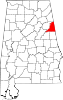 | |
| Towns | ||
| CDP | ||
| Unincorporated communities | ||