Geauga County Airport
Geauga County Airport | |||||||||||
|---|---|---|---|---|---|---|---|---|---|---|---|
 Airplanes on the runway at Geauga County Airport. | |||||||||||
| Summary | |||||||||||
| Airport type | Public | ||||||||||
| Owner/Operator | Geauga County | ||||||||||
| Serves | Middlefield, Ohio | ||||||||||
| Location | Middlefield | ||||||||||
| Elevation AMSL | 1,174.2 ft / 358 m | ||||||||||
| Website | [1] | ||||||||||
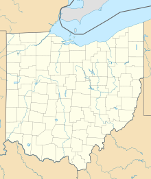
| Map | |||||||||||
 | |||||||||||
| Runways | |||||||||||
| |||||||||||
| Statistics (2010) | |||||||||||
| |||||||||||
Source:[2] | |||||||||||
Geauga County Airport (FAA LID: 7G8), is a public use airport in southern Geauga County, Ohio, United States.[2] Owned and operated by Geauga County since 1968,[3] it serves all of Geauga County. The airport is located 40 nautical miles (12 mi, 19 km) east of downtown Cleveland.
The airport was built in 1968 as part of a statewide initiative for each county to have its own airport.[4] It serves as the area base for University Hospitals' MedEvac medical helicopter,[5] as well as for The Cleveland Soaring Society, a glider club.[6] It is home to Experimental Aircraft Association Chapter 5.[7]
Facilities and aircraft
For the 12-month period ending August 26, 2011, the airport had an average of 20 aircraft movements per day: 97% general aviation, and 3% air taxi. At that time there were 42 aircraft based at this airport: 32 single-engine, 6 gliders, 3 ultralight and 1 helicopter.[2]

References
- ^ [1]
- ^ http://www.co.geauga.oh.us/Departments/Airport/Info.aspx Geauga County Airport General Information
- ^ http://www.news-herald.com/general-news/20090718/airport-hangars-on-hold-in-geauga
- ^ http://www.middlefieldohio.com/emergency-safety-services/medevac
- ^ http://www.clevelandsoaring.org/
- ^ Experimental Aircraft Association Chapter 5

