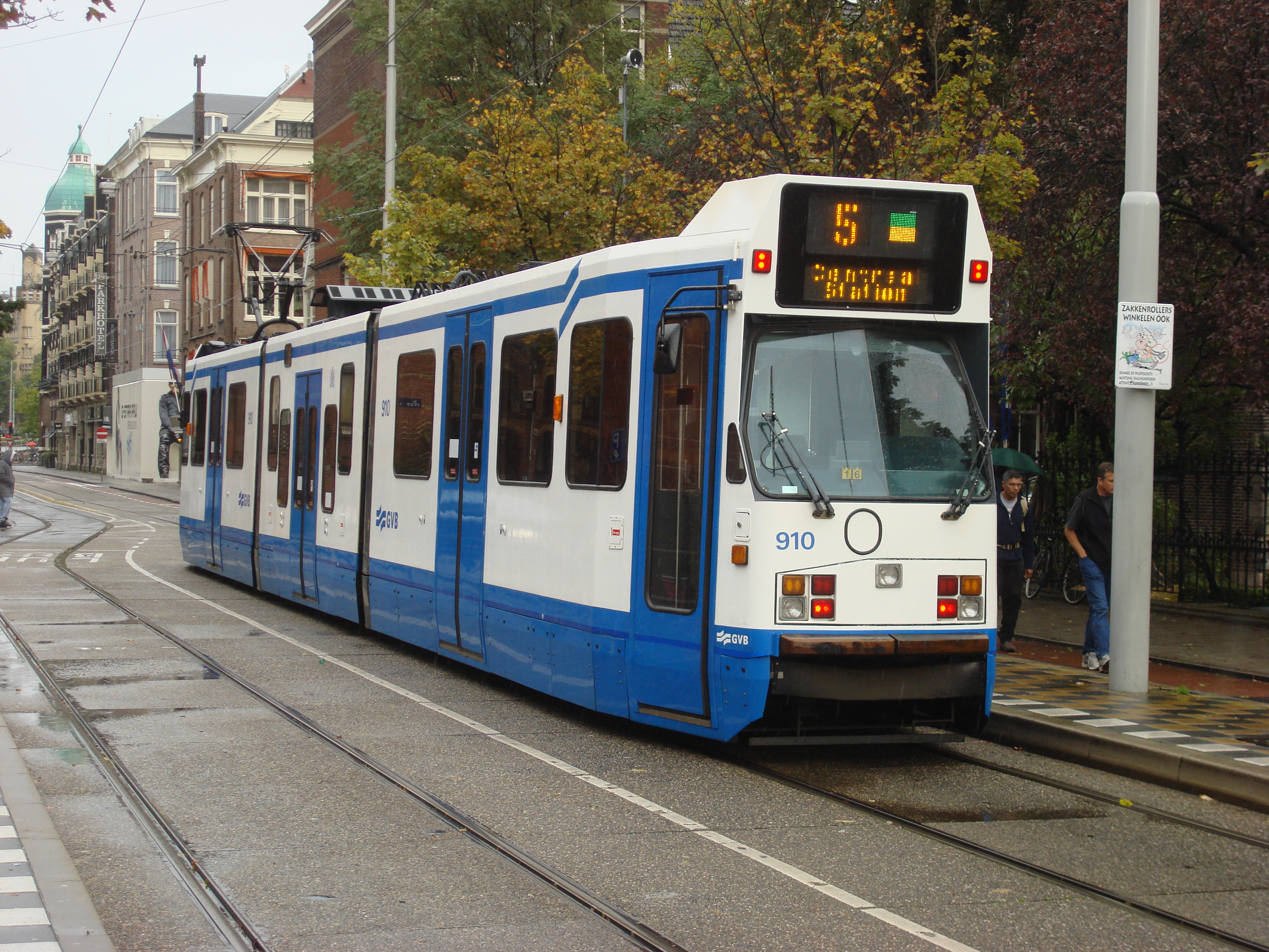
GVB (Amsterdam)
| GVB | |
|---|---|
 | |
| Overview | |
| Locale | Amsterdam |
| Transit type | Tram Metro Ferry Bus |
| Annual ridership | 211 million[1] |
| Operation | |
| Began operation | 1900 |
| Technical | |
| Track gauge | 1,435 mm (4 ft 8+1⁄2 in) standard gauge |
The Gemeentelijk Vervoerbedrijf or GVB is the municipal public transport operator for Amsterdam, the capital of the Netherlands, operating metro, tram, bus and ferry services in the Amsterdam Metropolitan Area since 2012.
GVB became a private corporation wholly owned by the city of Amsterdam in 2007, and will continue to operate public transport services under a negotiated contract until 2024.[contradictory][2]
History
The forerunner of the GVB, the Gemeentetram Amsterdam (GTA) (Amsterdam Municipal Tramway), was established in 1900 by the city after it acquired a private tram company (AOM). In 1925, it introduced its first bus line. In 1943, the GVB acquired its current form when Gemeentetram merged with Gemeenteveren Amsterdam (established in 1897), the municipal ferry company, and got its name Gemeentelijk Vervoerbedrijf (municipal transport company). In 1977, it introduced its first metro line. In 1990, it introduced its first light rail line. In 2007 GVB was privatised and hence the full name was abolished.
Network
The GVB operates a number of public transportation networks in and around the city of Amsterdam, including:
- 3 metro lines, partly elevated, no level crossings.
- 1 light rail (sneltram = fast tram) line to the neighboring town Amstelveen, partly using metro tracks, partly on the street with its own lanes, and with level crossings (Route 51).
- 14 tram routes, on street, partly mixed with all other traffic, partly on lanes shared with buses and taxis, and partly on separate lanes.
- many bus routes; buses often mix with other traffic, but sometimes on lanes shared with trams and taxis, or for buses only.
- Several ferries across the IJ; at least one is frequent, operating 24 hours a day, free of charge.
In addition, a new metro line, the North/South line, is under construction and is scheduled to be completed in 2018.
Since 2006 the responsible local authority for all public transport in the greater Amsterdam area is the City Region of Amsterdam / Stadsregio Amsterdam. In 2010 the SRA prolonged the concession (contract) of the GVB for the period 2012–2017. In accordance with the rules for public procurement in the European Union the SRA has to open a call for bids for the next period, which means that another company could be operating the public transport networks in Amsterdam after 2017.[contradictory]
Metro
- 1,435 mm (4 ft 8+1⁄2 in) gauge (standard gauge)
- power 750 volt DC
- Amsterdam, Diemen, Ouder-Amstel
Metro routes
- 50: Station Sloterdijk - Station Lelylaan - Station Zuid - Station Bijlmer ArenA - Gein
- 53: Amsterdam Centraal - Amstelstation - Station Diemen Zuid - Gaasperplas
- 54: Amsterdam Centraal - Amstelstation - Station Bijlmer ArenA - Gein
Light rail
- 1,435 mm (4 ft 8+1⁄2 in) gauge (standard gauge)
- power 600 volt / 750 volt DC
- Amsterdam, Amstelveen
Light rail route
- 51: Amsterdam Centraal - Amstelstation - Station Zuid - Buitenveldert - Amstelveen Westwijk
Line 51 to Amstelveen runs metro service between Central Station and Station Zuid. At Station Zuid it switches from third rail to pantograph and catenary wires. From there to Amstelveen Centrum it shares its track with tram line 5. The light rail vehicles on this line are capable of using both 600 volt DC and 750 volt DC.
Tram
- Track gauge 1,435 mm (4 ft 8+1⁄2 in) standard gauge
- power 600 volt DC
- Amsterdam, Amstelveen, Diemen
Tram routes
- 1: Amsterdam Centraal - Leidsestraat - Station Lelylaan - Osdorp De Aker
- 2: Amsterdam Centraal - Leidsestraat - Hoofddorpplein - Nieuw Sloten
- 3: Zoutkeetsgracht - Ceintuurbaan - Muiderpoortstation
- 4: Amsterdam Centraal - Utrechtsestraat - Station RAI
- 5: Amsterdam Centraal - Leidsestraat - Station Zuid - Amstelveen Binnenhof
- 7: Slotermeer - Leidseplein - Flevopark
- 9: Amsterdam Centraal - Plantage - Diemen Sniep
- 10: Westergasfabriek - Leidseplein - Azartplein
- 12: Station Sloterdijk - Ceintuurbaan - Amstelstation
- 13: Amsterdam Centraal - Rozengracht - Geuzenveld
- 14: Slotermeer - Dam - Plantage - Flevopark
- 16: Amsterdam Centraal - Vijzelstraat - De Lairessestraat - VU mc
- 17: Amsterdam Centraal - Rozengracht - Station Lelylaan - Osdorp Dijkgraafplein
- 26: Amsterdam Centraal - Piet Heintunnel - IJburg
Ferries
Ferries crossings on the IJ
GVB has offered a ferry connection* between Central Station and Amsterdam-Noord for over 100 years. The service is free of charge.[3]
Ferry boat crossings on the Noordzeekanaal
There are three ferry boats: Zaanstad (Hempont), Buitenhuizen (Buitenhuizerpont), and Velsen (Velserpont). The ferries run at least 3 times per hour, 24 hours per day, 7 day per week.[4]
Ticketing
The Amsterdam public transport network falls under the National Tariff System of the Netherlands and the GVB has a few of its own tickets, notably the 24-, 48- and 72- hour tickets. The electronic OV-chipkaart has been the only ticketing system valid in the Amsterdam metro since the summer of 2009, and in the rest of the network (tram, bus) since June 2010. Most trams carry conductors, but as they no longer stamp passengers' strippenkaarten their role has been deskilled; it now consists in ensuring security along with selling the occasional OV-chipkaart and optionally announcing the stops.
References
- ^ GVB (2013). "GVB Resources & numbers". GVB. Retrieved 9 June 2014.
- ^ "Transportation vision 2024". GVB. Retrieved 2014-07-18.
- ^ http://en.gvb.nl/ovinmamsterdam/soortenvervoer/Pages/Soorten-vervoer.aspx
- ^ http://en.gvb.nl/ovinmamsterdam/soortenvervoer/Pages/Soorten-vervoer.aspx


