Glenariff
Appearance

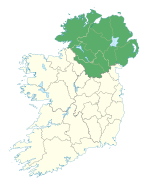
Glenariff or Glenariffe (from Irish Gleann Aireamh, meaning 'valley of the ploughman/arable valley')[1] is a valley in County Antrim, Northern Ireland. It is one of the Glens of Antrim. Like all glens in that area, it was shaped during the Ice Age by giant glaciers.
It is sometimes called the 'Queen of the Glens' and is the biggest and most popular of the Glens of Antrim. The village of Waterfoot lies on the coast at the foot of the glen.
A popular tourist destination is the Glenariff Forest Park with its trails through the trees and alongside picturesque waterfalls.
References
- Culture Northern Ireland
- "A Glimpse at Glenariffe" - Book ISBN 0-948154-61-6 (1997) by Robert Sharpe and Charles McAllister traces the history of the glen using maps, 17th century hearth rolls and school records.
55°01′56″N 6°04′46″W / 55.03222°N 6.07944°W

