
Gotska Sandön
| Gotska Sandön National Park | |
|---|---|
 The eastern coast, as seen from the lighthouse. | |
| Location | Gotland County, Sweden |
| Nearest city | Fårösund, Gotland Municipality |
| Coordinates | 58°22′N 19°15′E / 58.367°N 19.250°E |
| Area | 44.9 km2 (17.3 sq mi), of which 8.42 km2 (3.25 sq mi) are water.[1] |
| Established | 1909, extended in 1963 and 1988[1] |
| Governing body | Naturvårdsverket |

Gotska Sandön is an uninhabited Swedish island in the Baltic Sea, situated some 38 kilometres north of Fårö. It is approximately 9 kilometres long and 6 kilometres wide, and its area is approximately 36 km².
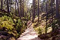
Gotska Sandön is mostly composed of sand and its scenery is dominated by beaches, dunes, and pine forests. The name "Gotska Sandön" literally translates as the Gotlandic Sand Island, from the province of which it forms part. Since 1909, it is one of the National parks of Sweden. Apart from a colony of grey seals, the higher fauna is not very rich. However, there are many rare insects and plants, including several kinds of orchids. During the summer, there are regular boat tours from Fårö Island and Nynäshamn on the mainland.
-
 The Schipka Pass, A handmade pass through the sand dunes
 -
 The eastern coast, as seen from the lighthouse
 -
 The north-eastern coast, an early morning


References
- ^ a b "Gotska Sandön National Park". Naturvårdsverket. Retrieved 2009-02-26.
External links
- Gotska Sandön (in Swedish)
- Gotska Sandön National Park (in Swedish)
- Gotska Sandön National Park (English)
- Birds on Gotska Sandön
This article about a location in Gotland County, Sweden is a stub. You can help Wikipedia by expanding it. |
This protected areas-related article is a stub. You can help Wikipedia by expanding it. |