Jump to content

Grampian

Coordinates: 57°13′41″N 2°59′17″W / 57.228°N 2.988°W / 57.228; -2.988
From Wikipedia, the free encyclopedia

This is an old revision of this page, as edited by ClueBot NG (talk | contribs) at 15:00, 21 January 2016 (Reverting possible vandalism by Heyitscraigg to version by Materialscientist. Report False Positive? Thanks, ClueBot NG. (2513771) (Bot)). The present address (URL) is a permanent link to this revision, which may differ significantly from the current revision.

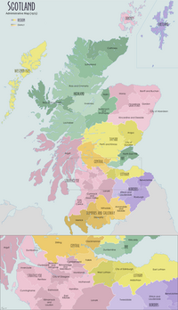
Grampian (Roinn a' Mhonaidh in Gaelic) was a local government region of Scotland from 1975 to 1996. It is now divided into the unitary council areas of:

The region had five districts:

The region took its name from the Grampian Mountains.

Grampian continues to have electoral, valuation, and Health boards.

Town twinning

See also

57°13′41″N 2°59′17″W / 57.228°N 2.988°W / 57.228; -2.988