Grey Islands

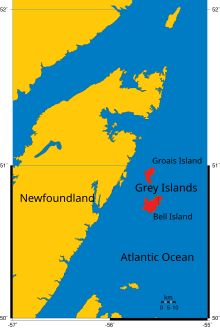
The Canadian Grey Islands consist of two islands, Bell Island and Groais Island, located off Newfoundland's Great Northern Peninsula to the east in the Atlantic Ocean.
Largest of them is the southern Bell Island with an area of 88 km². The islands are hilly, rising to over 152 m. (500 ft). The village of Grey Islands Harbour is situated at the southern end of Bell I.
See also
Sources
50°50′N 55°35′W / 50.833°N 55.583°W
