Grimselsee
Appearance
| Grimselsee Lake Grimsel | |
|---|---|
 | |
 map | |
| Location | Guttannen, Canton of Berne |
| Coordinates | 46°34′10.52″N 8°19′38.66″E / 46.5695889°N 8.3274056°E |
| Type | artificial lake, hydroelectric reservoir |
| Primary inflows | Oberaarbach, Treibtenbach |
| Primary outflows | Aare |
| Catchment area | 74.4 km2 (28.7 sq mi) |
| Basin countries | Switzerland |
| Surface area | 2.63 km2 (1.02 sq mi) |
| Water volume | 95 million cubic metres (77,000 acre⋅ft) |
| Surface elevation | 1,908 m (6,260 ft) |
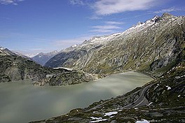
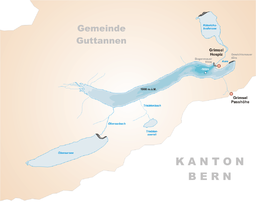
The Grimselsee or Lake Grimsel is an artificial lake near the Grimsel Pass in the Canton of Berne, Switzerland. With a volume of 95 mio m³, it is larger than other hydroelectric reservoirs in the region: Oberaarsee, Räterichsbodensee and Gelmersee. The dam was completed in 1932 and is operated by Kraftwerke Oberhasli AG (KWO). It is located in the municipality of Guttannen.
Lake Grimsel and Räterichsbodensee in the background.
External links
 Media related to Grimselsee at Wikimedia Commons
- KWO: Lake Grimsel

