Jump to content

Gulf of Nicoya

Coordinates: 9°48′N 84°48′W / 9.8°N 84.8°W / 9.8; -84.8
From Wikipedia, the free encyclopedia

This is an old revision of this page, as edited by Jllm06 (talk | contribs) at 01:59, 13 February 2014 (added Category:Geography of Puntarenas Province using HotCat). The present address (URL) is a permanent link to this revision, which may differ significantly from the current revision.

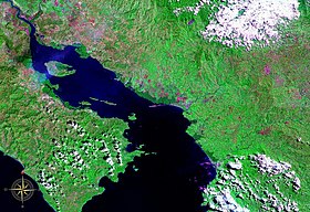
Gulf of Nicoya seen from space (false color)

The Gulf of Nicoya (Spanish: Golfo de Nicoya) is an inlet of the Pacific Ocean. It separates the Nicoya Peninsula from the mainland of Costa Rica, and encompasses a marine and coastal landscape of wetlands, rocky islands and cliffs.

Islands

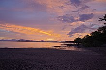
Sunset over the Nicoya Peninsula and Gulf of Nicoya

External links

9°48′N 84°48′W / 9.8°N 84.8°W / 9.8; -84.8