
Halssila
Halssila | |
|---|---|
District of Jyväskylä | |
 The center of Halssila | |
| Country | |
| Province | Western Finland |
| Region | Central Finland |
| Sub-region | Jyväskylä sub-region |
| City | Jyväskylä |
| Ward | Halssila |
| Time zone | UTC+2 (EET) |
| • Summer (DST) | UTC+3 (EEST) |
Halssila is one of the districts of Jyväskylä, Finland. The population of the area is about 6 000.[1] Halssila was merged into Jyväskylä in 1941.[2]
Halssila started to develop in the 1920s when factor workers started to build houses in the area.[3] In the 1970s the construction of new neighborhoods, mainly made of apartment buildings, was started.[3]
Subareas
Halssila consists several subareas, which are Tuohimutka, Aholaita, Aittorinne, Halssilanmäki, Halssilanranta, Kivistö, Halssilanrinne and Rauhalahti.[4]
Gallery
-
 Äijälänranta area in Rauhalahti.
 -
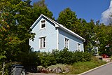 An old wooden house in Halssila.
 -
 An apartment building in Kivistö.
 -
 Halssila church


References
- ^ "SuurHalssila, Halssilan Asukasyhdistys ry". www.suurhalssila.fi. Retrieved 2018-08-09.
- ^ "Jyväskylän omakotialueita". www3.jkl.fi. Retrieved 2018-08-09.
- ^ a b "Asuinalueet | SuurHalssila, Halssilan Asukasyhdistys ry". www.suurhalssila.fi. Retrieved 2018-08-09.
- ^ "Jyväskylän karttapalvelu". kartta.jkl.fi (in Finnish). Retrieved 2018-08-09.