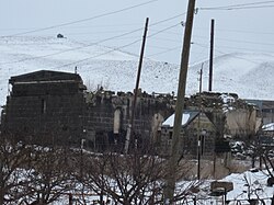
Hatsik, Shirak
Appearance
40°50′51″N 43°52′27″E / 40.84750°N 43.87417°E
Hatsik
Հացիկ | |
|---|---|
 | |
| Coordinates: 40°50′51″N 43°52′27″E / 40.84750°N 43.87417°E | |
| Country | Armenia |
| Province | Shirak |
| Municipality | Akhuryan |
| Elevation | 1,650 m (5,410 ft) |
| Population (2011) | |
| • Total | 937 |
| Time zone | UTC+4 |
Hatsik (Armenian: Հացիկ) is a village in the Akhuryan Municipality of the Shirak Province of Armenia.
Demographics
[edit]| Year | Pop. | ±% p.a. | ||
|---|---|---|---|---|
| 1831 | 327 | — | ||
| 1897 | 864 | +1.48% | ||
| 1926 | 888 | +0.09% | ||
| 1939 | 1,068 | +1.43% | ||
| 1959 | 879 | −0.97% | ||
| 1970 | 894 | +0.15% | ||
| 1979 | 820 | −0.96% | ||
| 1989 | 925 | +1.21% | ||
| 2001 | 1,081 | +1.31% | ||
| 2004 | 1,163 | +2.47% | ||
| ||||
| Source: [1] | ||||
Natural conditions
[edit]The climate is temperate. Winters are long and cold. There are severe winds snow storms. The annual precipitation is about 500 to 600 mm (20 to 24 in). Blach tuff and coal reserves are in the area. The village is located 4.5 km (2.8 mi) northeast of the regional capital of Gyumri. It is 1,650 m (5,410 ft) above sea level. The lowest temperature of -25% to +35%. The village is in a seismic zone where earthquakes are frequent.[2]
References
[edit]- ^ Հայաստանի Հանրապետության բնակավայրերի բառարան [Republic of Armenia settlements dictionary] (PDF) (in Armenian). Yerevan: Cadastre Committee of the Republic of Armenia. 2008. Archived from the original (PDF) on 11 March 2018.
- ^ SHIRAK
- Hatsik, Shirak at GEOnet Names Server
- World Gazeteer: Armenia[dead link] – World-Gazetteer.com
- Report of the results of the 2001 Armenian Census, Statistical Committee of Armenia


