Jump to content

Hlabta

Coordinates: 34°15′19″N 36°17′15″E / 34.25528°N 36.28750°E / 34.25528; 36.28750
From Wikipedia, the free encyclopedia

This is an old revision of this page, as edited by Mark Mercer (talk | contribs) at 07:59, 1 December 2017 (Created page with '{{Infobox settlement <!-- See Template:Infobox settlement for additional fields and descriptions --> <!-- Basic info ----------------> |official_name =...'). The present address (URL) is a permanent link to this revision, which may differ significantly from the current revision.

(diff) ← Previous revision | Latest revision (diff) | Newer revision → (diff)
Hlabta
حلبتا
Village
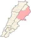
Hlabta is located in Lebanon
Hlabta
Hlabta
Location in Lebanon
Coordinates: 34°15′19″N 36°17′15″E / 34.25528°N 36.28750°E / 34.25528; 36.28750
Country Lebanon
GovernorateBaalbek-Hermel Governorate
DistrictBaalbek District
Elevation
3,900 ft (1,200 m)
Time zoneUTC+2 (EET)
 • Summer (DST)+3

Hlabta (Template:Lang-ar) is a village located in the Baalbek District of the Baalbek-Hermel Governorate in Lebanon.[1]

References

  1. ^ "Hlabta (Baalbek)". Localiban. Localiban. 2007-12-07. Retrieved 2017-12-01.