
Jeffersonton, Virginia
Jeffersonton, Virginia | |
|---|---|
 Jeffersonton United Methodist Church | |
 Jeffersonton  Jeffersonton | |
| Coordinates: 38°38′13″N 77°54′54″W / 38.63694°N 77.91500°W | |
| Country | United States |
| State | Virginia |
| County | Culpeper |
| Elevation | 459 ft (140 m) |
| Time zone | UTC-5 (Eastern (EST)) |
| • Summer (DST) | UTC-4 (EDT) |
| ZIP code | 22724 |
| Area code | 540 |
| GNIS feature ID | 1477444[1] |
Jeffersonton is an unincorporated community in Culpeper County, Virginia, United States. Jeffersonton is 12.2 miles (19.6 km) north-northeast of Culpeper.
History
Jeffersonton was platted in 1798 and was named for Thomas Jefferson.[1]
Notable residents
- William Meade Fishback – 17th Governor of Arkansas and U.S. Senator-Elect for Arkansas
- Douglas W. Owsley
References
Municipalities and communities of Culpeper County, Virginia, United States | ||
|---|---|---|
| Town | 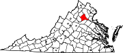 | |
| CDP | ||
| Other communities | ||
This Culpeper County, Virginia state location article is a stub. You can help Wikipedia by expanding it. |