Jones Ice Shelf

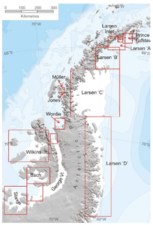
Jones Ice Shelf (67°31′S 67°1′W / 67.517°S 67.017°W) was the ice shelf occupying the Jones Channel, between the Arrowsmith Peninsula and Blaiklock Island, on the west coast of Graham Land, Antarctica. It was named by the UK Antarctic Place-Names Committee in 1981 in association with the channel.[2]
The shelf was stable between 1947 and 1969, rising from 3 to 12 metres (10 to 40 ft) above sea level as it blocked the channel. It started to retreat in the 1970s and by 2003 had completely disappeared.[3]
See also
References
- ^ A. J. Cook; D. G. Vaughan (2009). "Ice shelf changes on the Antarctic Peninsula" (PDF). The Cryosphere Discussions. 3: 579–630. doi:10.5194/tcd-3-579-2009.
{{cite journal}}: CS1 maint: unflagged free DOI (link) - ^ "Jones Ice Shelf". Geographic Names Information System. United States Geological Survey, United States Department of the Interior. Retrieved 2013-04-05.
- ^ Fox A.J., Vaughan D.G. (2005). "The retreat of Jones Ice Shelf, Antarctic Peninsula". Journal of Glaciology. 51: 555–560. doi:10.3189/172756505781829043.
![]() This article incorporates public domain material from "Jones Ice Shelf". Geographic Names Information System. United States Geological Survey.
This article incorporates public domain material from "Jones Ice Shelf". Geographic Names Information System. United States Geological Survey.
