
Jukdo (island)

| Korean name | |
| Hangul | |
|---|---|
| Hanja | |
| Revised Romanization | Jukdo |
| McCune–Reischauer | Chukto |
Jukdo (죽도/竹島) is a small island adjacent to Ulleungdo, South Korea. It was formerly also known as Jukseodo (죽서도/竹嶼島), as Boussole Rock in Europe. It lies 2 km (1 mi) east of Ulleungdo, and is the largest island in the group apart from Ulleungdo itself. In 2004, one family of three members were living on the island.
Outline
Administratively, Jukdo belongs to Jeodong-ri, Ulleung township, Ulleung County, Gyeongsangbuk-do. The Chinese characters used to write this island is Jukseodo (竹嶼島). Jukdo island, measuring 734 metres (0.456 mi) long and 482 metres (0.300 mi) wide.
The Chinese characters for Jukdo (竹島) or Jukseo (竹嶼) mean "bamboo(竹) island(島)/islet(嶼)". Bamboo grasses grow in Jukdo. And The Chinese characters in Japanese for Liancourt Rocks, also known as Dokdo (독도, 獨島), is Takeshima (竹島). The former means "獨(lonely) 島(island)". The latter means "竹(bamboo) 島(island)", which originates from old Japanese name for Ulleungdo.
Position and Satellite photo
- Ulleungdo/Jukdo
-
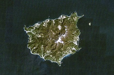 A satellite photo (the top, north) of Ulleungdo. An island looking small northeast of Ulleungdo is Jukdo.
 -
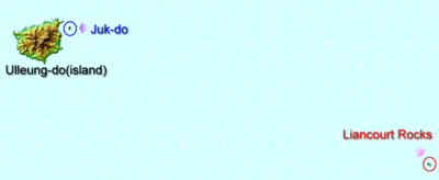 Position of Uleungdo, Jukdo and Liancourt Rocks


Old Korean maps
- Ulleungdo/Jukdo
-
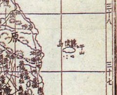
 Joseon map(1530)
 -
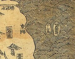 Joseon map(1530)
 -
 Kim Jeong-ho"Daedongyeojido"(1861)
 -
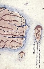 Kim Jeong-ho"Daedongyeojido"(1861)
 -
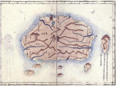
 A map by Korean Empire(1899)


See also
37°31′44″N 130°56′17″E / 37.529°N 130.938°E
This South Korea location article is a stub. You can help Wikipedia by expanding it. |