Jurassic Coast
| UNESCO World Heritage Site | |
|---|---|
 | |
| Criteria | Natural: viii |
| Reference | 1029 |
| Inscription | 2001 (25th Session) |
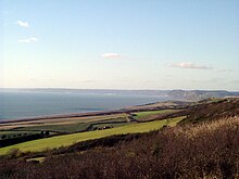
The Jurassic Coast is a World Heritage Site on the English Channel coast of southern England. The site stretches from Orcombe Point near Exmouth in East Devon to Old Harry Rocks near Swanage in East Dorset, a distance of 153 kilometres (95 mi).[1] Chartered in 2001, the Jurassic coast was the second wholly-natural World Heritage Site to be designated in the United Kingdom. Its entire length can be walked on the South West Coast Path.[2]
Geology

The Jurassic Coast consists of Triassic, Jurassic and Cretaceous cliffs, spanning the Mesozoic Era, documenting 180 million years of geological history. The site contains a number of unique geological features and shows excellent examples of different landforms, including the natural arch at Durdle Door, the cove and limestone folding at Lulworth Cove and an island, the Isle of Portland. Chesil Beach is a fine example of both a tombolo and a storm beach. The site has stretches of both concordant and discordant coastlines. Due to the quality of the varied geology, the site is the subject of international field studies. This area was home to Mary Anning, a palaeontologist who studied the fossils of the coastline around Lyme Regis and discovered the first complete Ichthyosaur fossil. The highest point on the Jurassic Coast, and the entire south coast of England, is Golden Cap at 191 metres (627 ft).
History

The site was featured on the television programme Seven Natural Wonders as one of the wonders of the South West (of the UK), and in a 2005 poll of Radio Times readers, the Jurassic Coast was named as the 5th greatest natural wonder in Britain.
During World War II several sections of the Jurassic Coast became property of the then Ministry of War. One of the Royal Navy's largest bases was at Portland Harbour, though it has since closed. A major army base at Bovington remains in use today, and large areas of land, including the coast between Lulworth Cove and Kimmeridge, including Tyneham ghost village, are still only partially accessible. Areas of the coast near Exmouth, The Fleet at Weymouth and the beaches at Studland were also used for training during the war, but have since been returned to civilian use.
Parts of the coast, especially around Portland, can be very dangerous, and frequent shipwrecks have been a feature of the coast throughout recorded history. In January 2007 the coast experienced its most environmentally damaging wreck when the MSC Napoli, a 2,400 capacity container ship, was beached at Branscombe near Sidmouth, losing oil and cargo.[3]
On May 6 2008, a 400-metre (1,312 ft) section of the coast was destroyed after a landslip that was described as the worst in 100 years.[4]
Gateway towns


West Bay forms a major gateway to the Jurassic Coast with the completion in 2004 of the Jurassic Pier.[5] Weymouth is also a major gateway town, near the centre of the world heritage site. A World Heritage Coast Centre is to be built in the town by 2011.[6] Other gateway towns include:
- Abbotsbury
- Bridport
- Budleigh Salterton
- Charmouth — Charmouth Heritage Coast Centre
- Exmouth
- Lulworth
- Lyme Regis
- Seaton
- Sidmouth
- Swanage
See also
References
- ^ "Dorset and East Devon Coast". UNESCO World Heritage Centre. 2001. Retrieved 2007-01-14.
{{cite web}}: Cite has empty unknown parameter:|coauthors=(help) - ^ "The Official Guide to the SWCP". SWCP Team. 2004. Retrieved 2007-01-14.
{{cite web}}: Cite has empty unknown parameter:|coauthors=(help) - ^ BBC News, 2007. Stricken cargo ship run aground.
- ^ BBC News, 2008. Landslip is 'worst in 100 years'.
- ^ "Jurassic Pier". Resort Marketing Ltd. 2004. Retrieved 2007-01-14.
{{cite web}}: Cite has empty unknown parameter:|coauthors=(help) - ^ "Weymouth Pavilion & Ferry Terminal—The scheme so far". Howard Holdings PLC. 2007. Retrieved 2007-08-20.
{{cite web}}: Cite has empty unknown parameter:|coauthors=(help)
External links
- The official Jurassic Coast Website
- The South West Coast Path National Trail
- UNESCO's page on the Jurassic Coast
- UNEP's page on the Jurassic Coast
- The Dorset Coast Forum
- South West Grid for Learning, Dorset Coast Forum, Countryside Agency and Dorset & Devon County Council joint Jurassic Coast site
- National Geographic article on the Jurassic Coast
- BBC News Article on the Jurassic Coast
- Information on the Heritage Coast of Devon and Dorset
- Information, History, Photos etc
- Geology of the Wessex Coast by Ian West, Southampton University
Artwork
- Art of the Jurassic Coast
- The Mulberry Tree Gallery - Art Gallery specialising in the Jurassic Coast

